Pinna nobilis mapping in Posidonia oceanica meadows by video-photographic techniques in the Gulf of Oristano, Sardinia
- Published
- Accepted
- Subject Areas
- Marine Biology
- Keywords
- mapping, photo mosaic, 3D reconstruction, photogrammetric softwares, GIS, Pinna nobilis
- Copyright
- © 2015 Rende et al.
- Licence
- This is an open access article distributed under the terms of the Creative Commons Attribution License, which permits unrestricted use, distribution, reproduction and adaptation in any medium and for any purpose provided that it is properly attributed. For attribution, the original author(s), title, publication source (PeerJ PrePrints) and either DOI or URL of the article must be cited.
- Cite this article
- 2015. Pinna nobilis mapping in Posidonia oceanica meadows by video-photographic techniques in the Gulf of Oristano, Sardinia. PeerJ PrePrints 3:e1055v1 https://doi.org/10.7287/peerj.preprints.1055v1
Abstract
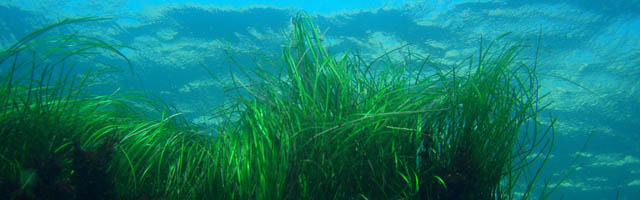
Pinna nobilis spatial distribution have been analysed trough a video - photographic approach in a Posidonia oceanica meadow in the Gulf of Oristano (Sardinia, Italy). In situ visual censuses and 2D/3D georeferenced vertical photographic survey were conducted by SCUBA diving in different sampling transect. The experimental procedure was carried out in the summer of 2014. Data have been processed using the photogrammetric techniques, in particular, in this work we presented the procedure and processing techniques to realize the orthographic planar micro cartography mosaics from photo sequences. Results of this study, although preliminary, showed the time-cost effectiveness of this approach to map the benthic species.
Author Comment
This in an abstract which has been accepted as a poster presentation at the 4th Mediterranean Seagrass Workshop 2015.