A new methodology for monitoring P. oceanica meadows in Tavolara Punta Coda Cavallo MPA using GIS
- Published
- Accepted
- Subject Areas
- Conservation Biology
- Keywords
- Marine Protected Areas, management, Geographic Information System (GIS), habitats, mapping, 3D, Posidonia oceanica, geomorphology, biocenosis, gridding.
- Copyright
- © 2015 Panzalis et al.
- Licence
- This is an open access article distributed under the terms of the Creative Commons Attribution License, which permits unrestricted use, distribution, reproduction and adaptation in any medium and for any purpose provided that it is properly attributed. For attribution, the original author(s), title, publication source (PeerJ PrePrints) and either DOI or URL of the article must be cited.
- Cite this article
- 2015. A new methodology for monitoring P. oceanica meadows in Tavolara Punta Coda Cavallo MPA using GIS. PeerJ PrePrints 3:e1012v1 https://doi.org/10.7287/peerj.preprints.1012v1
Abstract
Marine Protected Areas (MPAs) are acknowledged globally as effective tools for the protection and management of the marine environment; however, to get effective results it is necessary to set up a proper and continuous mapping of the marine territory, in order to gain detailed knowledge of its different aspects. Therefore, the implementation and maintenance of a modern GIS (Geographic Information System) has become an indispensable task for the MPA of Tavolara - Punta Coda Cavallo to collect, aggregate, classify, and track the conducted mapping activities.
Between 2011 and 2012 the sea bottom of the MPA was surveyed using different methods: by means of a multi-beam echo sounder and of a side scan sonar, as well as conducting fast scientific scuba divings with re-breathers and underwater position system technologies. High resolution geodatasets, characterized by a significantly high quality in representing and describing the sea bottom and its habitats, were produced in both feature (scale up to 1:1.250) and raster formats (up to 30cm/pixel for sonar images and 1m/pixel for bathymetry) and they currently constitute the basis of the MPA's GIS, including its 3D applications and its web map services for desktop and mobile devices (iPhone & Android).
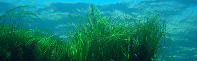
To update the above described geodatasets during time, acquiring new data on the conservation targets considered in monitoring activities, among which the status of P. oceanica meadows is of the most important ones, a long term mapping plan was realized on the basis of an innovative methodology elaborated by the MPA considering both the wideness of the area and the limited funds available at present. The whole MPA was divided in territorial units by means of a regular grid of square cells having a 100m side with the logic of starting the mapping activities from the mainly important areas and then to spread the surveys up to fill the whole mosaic. All the new data acquired with this methodology could then be mixed, compared and indexed within the same cell and/or in the many already available geodatases, starting from those dated 2006 having a regular grid with square cells of 500m per side.
Author Comment
This is an abstract which has been accepted as a poster presentation at the 4th Mediterranean Seagrass Workshop 2015.