
Hotspot analysis: a first prototype Python plugin enabling exploratory spatial data analysis into QGIS
- Published
- Accepted
- Subject Areas
- Data Science, Spatial and Geographic Information Systems
- Keywords
- QGIS, Hotspot Analysis, Python, FOSS, ESDA
- Copyright
- © 2016 Oxoli et al.
- Licence
- This is an open access article distributed under the terms of the Creative Commons Attribution License, which permits unrestricted use, distribution, reproduction and adaptation in any medium and for any purpose provided that it is properly attributed. For attribution, the original author(s), title, publication source (PeerJ Preprints) and either DOI or URL of the article must be cited.
- Cite this article
- 2016. Hotspot analysis: a first prototype Python plugin enabling exploratory spatial data analysis into QGIS. PeerJ Preprints 4:e2204v4 https://doi.org/10.7287/peerj.preprints.2204v4
Abstract
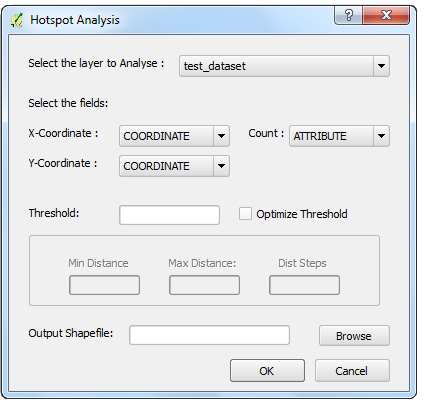
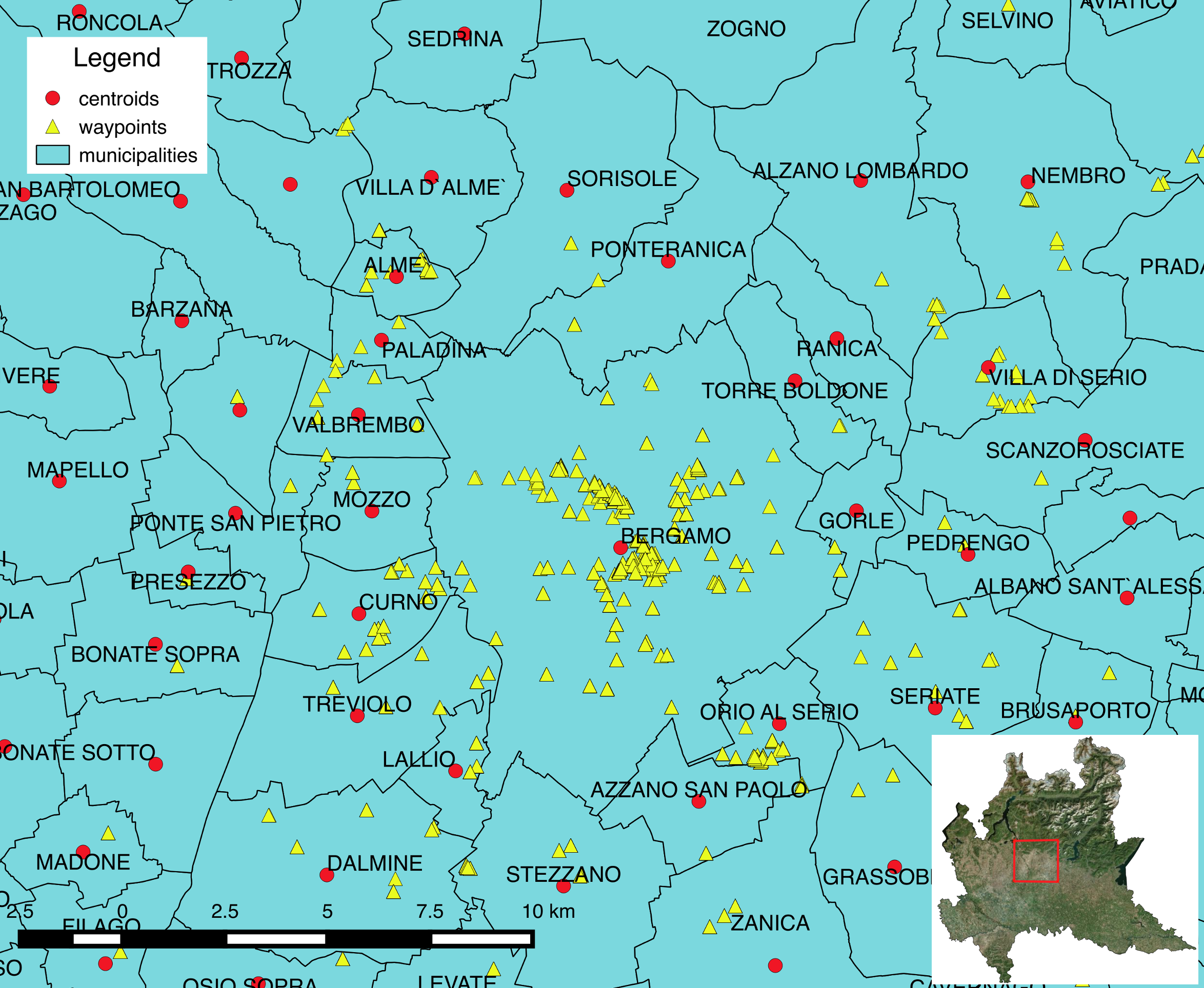
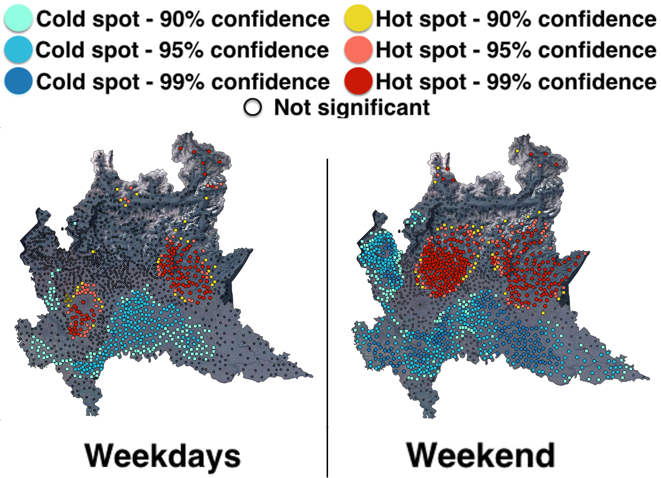
The growing popularity of Free and Open Source (FOSS) GIS software is without doubts due to the possibility to build and customize geospatial applications to meet specific requirements for any users. From this point of view, QGIS is one of the most flexible as well as fashionable GIS software environment which enables users to develop powerful geospatial applications using Python. Exploiting this feature, we present here a first prototype plugin for QGIS dedicated to Hotspot analysis, one of the techniques included in the Exploratory Spatial Data Analysis (ESDA). These statistics aim to perform analysis of geospatial data when spatial autocorrelation is not neglectable and they are available inside different Python libraries, but still not integrated within the QGIS core functionalities. The main plugin features, including installation requirements and computational procedures, are described together with an example of the possible applications of the Hotspot analysis.
Author Comment
This version of the paper was formatted according the the guidelines provided by OGRS committee.