Assessment of Posidonia oceanica status along the north Croatian coast (Adriatic Sea)
- Published
- Accepted
- Subject Areas
- Conservation Biology, Marine Biology
- Keywords
- seagrass meadows, monitoring, health status, Northern Adriatic Sea
- Copyright
- © 2015 Guala et al.
- Licence
- This is an open access article distributed under the terms of the Creative Commons Attribution License, which permits unrestricted use, distribution, reproduction and adaptation in any medium and for any purpose provided that it is properly attributed. For attribution, the original author(s), title, publication source (PeerJ PrePrints) and either DOI or URL of the article must be cited.
- Cite this article
- 2015. Assessment of Posidonia oceanica status along the north Croatian coast (Adriatic Sea) PeerJ PrePrints 3:e983v1 https://doi.org/10.7287/peerj.preprints.983v1
Abstract
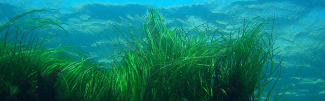
Monitoring of Posidonia oceanica was carried out in the framework of the MedMPAnet Project in eight meadows not formerly explored in an area along the north coast of Croatia (Primorje-Gorski Kotar County, Northern Adriatic Sea). The survey was aimed to collect preliminary data as a baseline for future surveillance cycles of the priority habitat 1120 "Posidonia beds" within the framework of the National Monitoring Programme, according to the requirements of the EU Habitats Directive. Fieldwork was carried out in 2013 and 2014 through direct SCUBA diving surveys. At each site, general information on coastal features and potential human pressures was recorded and the following descriptors of meadow conditions were assessed at three depth ranges: shoot density, percent coverage of Posidonia oceanica, dead matte and substrate type; depth and type of lower limits were also recorded for each meadow. Two meadows, located in the island of Rab (Uvala Planka and Frkanj), were investigated during both years of survey in order to test any differences due to the methodological approach we used. Overall, results indicated signs of distress for several meadows. Density ranged from 355±22 to 629±21 shoot per m2 at shallow stations (<10 m depth), from 141±8 to 324±23 shoot per m2 at intermediate depth (about 15 m), and from 79±5 to 157±10 shoot per m2 at the lower limit. Regression was also testified by high coverage of dead matte (locally >40%) especially at the lower limit, which was regressive in four meadows and in no case did it exceed 27 meters in depth. The temporal comparison provided consistent results between the two years for investigation of shoot density, at all sites and throughout the bathymetric range. However, some changes were detected in the deepest portions of both meadows in the coverage of Posidonia oceanica (lower than 50% in 2014). Further monitoring and research campaigns are recommended to improve the level of knowledge on the status of meadows in this area, to develop a baseline for assessing trends on a long-term temporal scale as requested by Habitats Directive, and to shed light on the relevance of both environmental and anthropogenic factors in determining the health status of the meadows. Intercalibration among operators is also suggested to ensure reliable data in implementing the National Monitoring Programme.
Author Comment
This is an abstract which has been accepted as a poster presentation at the 4th Mediterranean Seagrass Workshop 2015.