A GRASS tool for the Sediment Delivery Ratio mapping
- Published
- Accepted
- Subject Areas
- Data Science, Spatial and Geographic Information Systems
- Keywords
- soil erosion, sediment delivery ratio, DEM, GIS
- Copyright
- © 2016 De Rosa et al.
- Licence
- This is an open access article distributed under the terms of the Creative Commons Attribution License, which permits unrestricted use, distribution, reproduction and adaptation in any medium and for any purpose provided that it is properly attributed. For attribution, the original author(s), title, publication source (PeerJ Preprints) and either DOI or URL of the article must be cited.
- Cite this article
- 2016. A GRASS tool for the Sediment Delivery Ratio mapping. PeerJ Preprints 4:e2227v1 https://doi.org/10.7287/peerj.preprints.2227v1
Abstract
This work involves the implementation of a tool for evaluating Sediment Delivery Ratio (SDR) in a river basin, through GRASS GIS software. The definition of a spatially distributed value of SDR is a very important task as the sediment routing can affect solid transport in stream channels, water quality degradation, and frequency increase of natural disasters such as debris flows and mudflows. For such reason the SDR evaluation, coupled with GIS approach, has been extensively used in scientific literature. Geographic information systems provide a fundamental support for a better prediction of the SDR, since it can consider the space variability of factors influencing the sediment routing processes. Actually a specific GIS module to estimate the spatial variability of SDR does not exist. We implemented a GRASS GIS module (in python language) called r.sdr where the sediment delivery ratio is evaluated by GIS procedure by using several SDR equations available in literature. We applied the tool to the Feo Creek watershed, located in the Apennines area of northeastern Umbria (Italy).
Author Comment
This preprint is part of the PeerJ Open Source Geospatial Research & Education Symposium (OGRS2016).
Supplemental Information
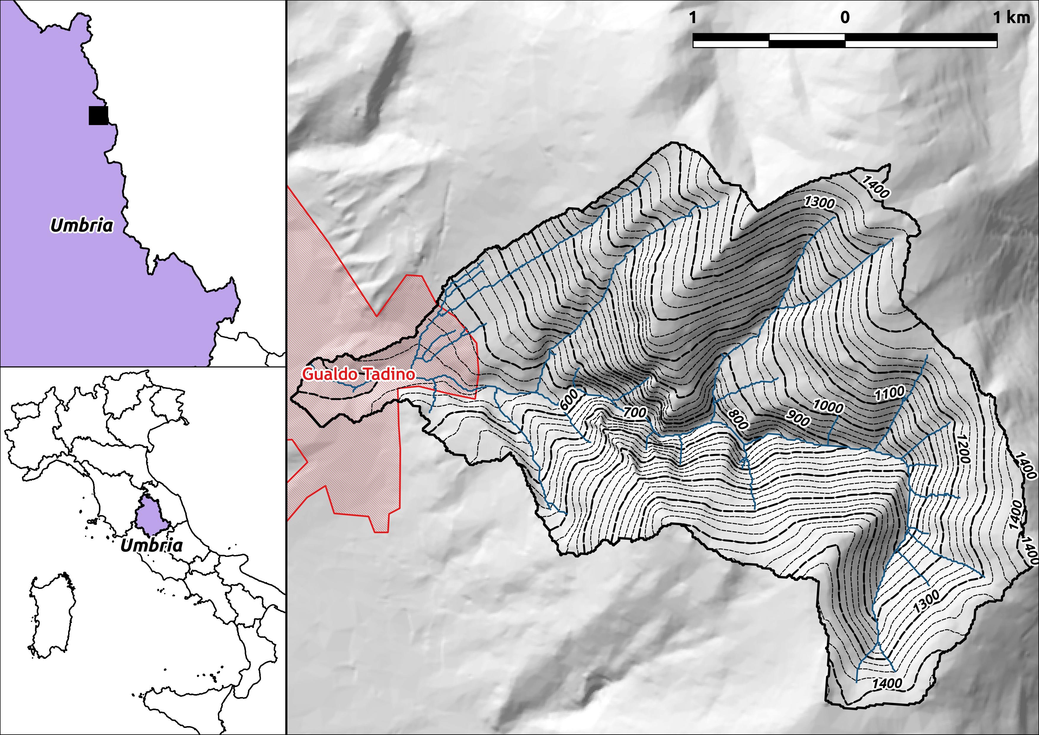
study area
Study area boundary (watershed of the Feo Creek), located in the Apennine area of northeastern Umbria (Umbria-Marche internal ridge).
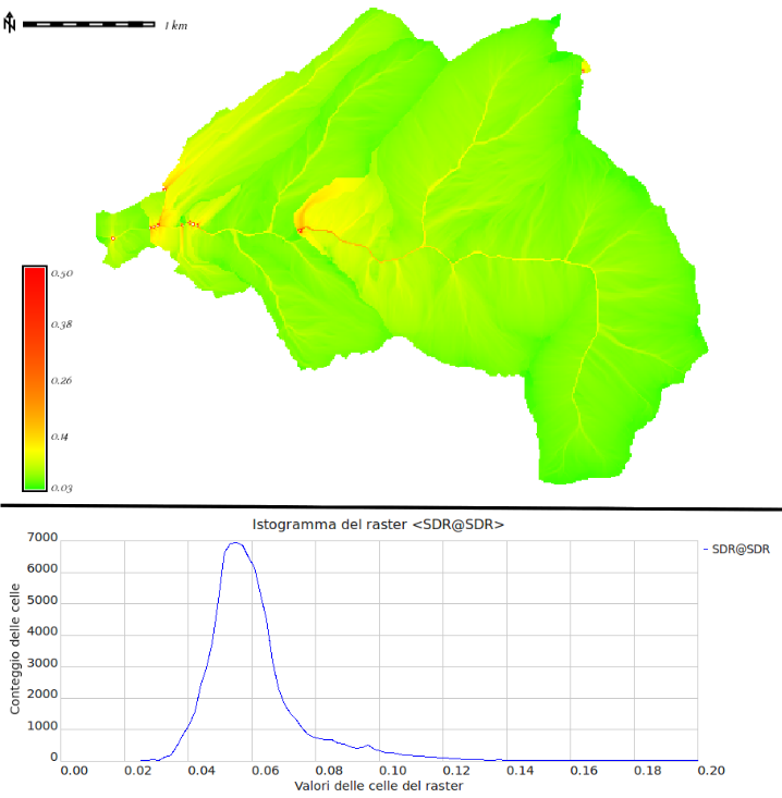
SDR output map
Sediment delivery ratio raster map calculated using the \citet{vigiak2012comparison} formula, from the \textit{connectivity index}. The figure bottom shows the histogram distribution for the SDR values over the studied basin.
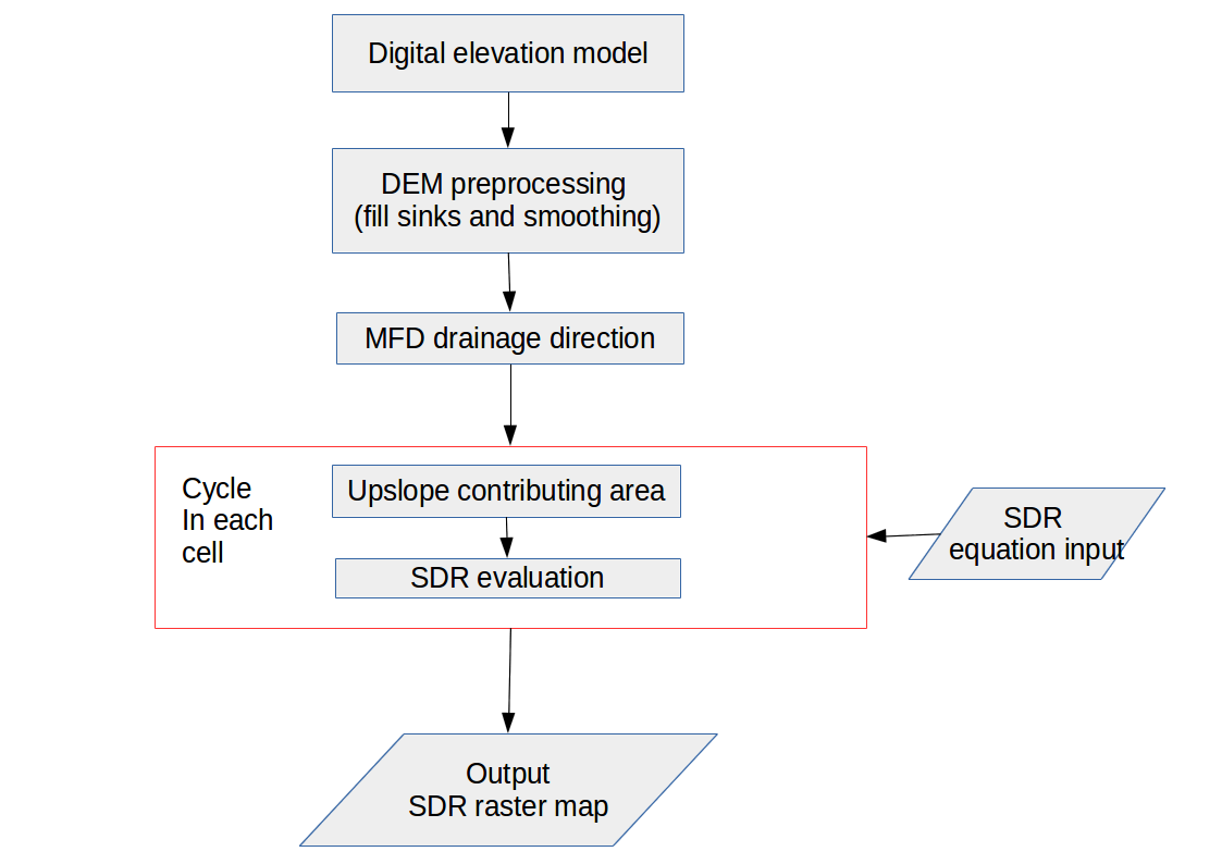
Workflow diagram
Workflow diagram for the \texttt{r.sdr} GRASS GIS module implemented