Towards a global dataset of seagrass occurrences: current progress, knowledge gaps and challenges
- Published
- Accepted
- Subject Areas
- Biodiversity, Biosphere Interactions, Climate Change Biology, Natural Resource Management
- Keywords
- biodiversity, policy
- Copyright
- © 2015 Weatherdon et al.
- Licence
- This is an open access article distributed under the terms of the Creative Commons Attribution License, which permits unrestricted use, distribution, reproduction and adaptation in any medium and for any purpose provided that it is properly attributed. For attribution, the original author(s), title, publication source (PeerJ PrePrints) and either DOI or URL of the article must be cited.
- Cite this article
- 2015. Towards a global dataset of seagrass occurrences: current progress, knowledge gaps and challenges. PeerJ PrePrints 3:e1161v1 https://doi.org/10.7287/peerj.preprints.1161v1
Abstract
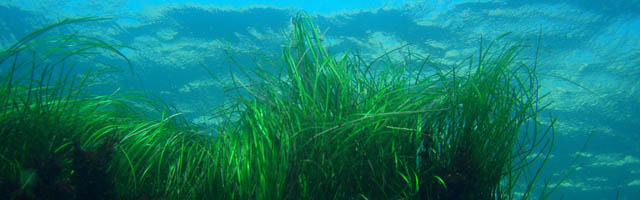
For a number of years, the United Nations Environment Programme World Conservation Monitoring Centre (UNEP-WCMC) has collaborated with Dr. Frederic Short (SeagrassNet, University of New Hampshire) and other seagrass experts worldwide to compile a global georeferenced dataset of seagrass occurrences. More than 184,000 point and polygon records have been collated to date. The GIS dataset and associated metadata can be downloaded from UNEP-WCMC’s Ocean Data Viewer, thereby providing ready-for-use information on the location of this critical habitat to policy-makers, conservationists, and scientists. This knowledge is necessary to inform better decisions regarding marine conservation (e.g., marine spatial planning) and to ensure the sustainable use of our ocean’s resources (e.g., ecosystem service valuation). This and other similar datasets on the distribution of key marine habitats—e.g., saltmarshes, mangroves, and corals (also curated and distributed by UNEP-WCMC)—have been used in numerous global and regional studies that examine the status of sensitive marine biodiversity and related impacts. Occurrence datasets such as these are also used to inform predictive models aimed at filling spatial gaps in knowledge. Moreover, such a global dataset can support analyses that explore the contribution of seagrass and other ‘blue carbon’ ecosystems (e.g. saltmarsh, mangrove) to carbon sequestration, thereby aiding climate change mitigation. As part of an interactive session, we will: 1. Present current progress towards collating a global dataset of seagrass occurrences, highlighting the achievements of such collaborative endeavours and the relevance of this dataset to global science, conservation, and policy initiatives; and 2. Facilitate a discussion with Mediterranean seagrass experts to develop recommendations for addressing the knowledge gaps and challenges (e.g. licensing issues) that have been identified. In particular, this session will focus on improving our collective knowledge of the spatial distribution of seagrass ecosystems in data-poor regions of the Mediterranean by drawing from local and regional expertise. Given the importance of these ecosystems to sustaining marine biodiversity, regulating carbon, and supporting global fisheries, such contributions towards developing a comprehensive and accurate dataset can help to ensure that scientists, conservationists, policy-makers and other decision-makers have the appropriate information to make better-informed analyses and decisions.
Author Comment
This is the abstract of a presentation given at the 4th Mediterranean Seagrass Workshop, Oristano (Italy), 18-22 May 2015.