
The Student Conference in Conservation Science began in Cambridge in 2000, and for 24 years it has attracted postgraduate students and others just starting out on their conservation careers. Over three packed days (and evenings), delegates listen to talks from other student delegates, attend workshops and network at several social events.
This year, the Department of Zoology in Cambridge welcomed 149 delegates from around the world – from Cuba, Indonesia, Mongolia, Uganda and France to name a few – for 33 student delegate talks and 62 posters. There were also four plenary talks from Brendan Godley (University of Exeter), Sarobidy Rakotonarivo (University of Antananarivo), Melissa Leach (Cambridge Conservation Initiative) and Bernardo Strassburg (International Institute for Sustainability).
The conference is designed to support young conservation scientists at a crucial time in their lives: inspiring them, encouraging them, giving them the opportunity to learn new skills, make new friends and meet new collaborators from around the world.
Rachel Spring, University of Cambridge
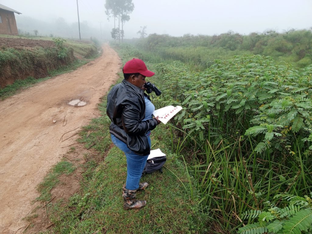
Loy Natukunda MSc student, Kabale University, Uganda.
 Can you tell us a bit about yourself and your research interests?
I’m passionate about biodiversity conservation, sustainable land use, and the intersection between community development and ecosystem services. My academic journey has focused on environmental science, GIS and remote sensing, and conservation. Professionally, I am currently involved in implementing community-driven conservation projects in Uganda, particularly around protected areas. I’m especially interested in forests, wetlands and their unique biodiversity, and how these ecosystems can be used as indicators for conservation planning.
What first interested you in this field of research?
Growing up in the biodiversity-rich landscapes of southwestern Uganda sparked my fascination with nature. Over time, I became increasingly aware of the threats facing wetlands and forests due to human activity. I wanted to understand how we can balance development with conservation. This led me to pursue studies in environmental and natural resource management and engage in field-based research that can inform sustainable policies and community action.
Can you briefly explain the research you presented at SCCS 2025?
At SCCS 2025, I presented my research on “Papyrus birds as indicators of a wetland Key Biodiversity Area (KBA)”, focusing on the Rushebeya-Kanyabaha Wetland in southwestern Uganda. My study assessed the abundance and distribution of papyrus-endemic bird species, such as the Papyrus Yellow Warbler, to evaluate the wetland’s potential as a KBA. I used field bird surveys and spatial analysis to identify habitat quality and human activities influencing bird presence and abundance. The findings support the urgent need for conservation attention in the area and contribute to the broader efforts of identifying and protecting critical papyrus wetland habitats.
How will you continue to build on this research?
I plan to expand this research by integrating more ecological indicators, such as plant diversity, seasonal variations and hydrological changes, to better understand the drivers of biodiversity in papyrus wetlands. I am also working on publishing the findings to contribute to the global knowledge base on wetland KBAs. Through my role at Nature Uganda, I’ll continue collaborating with local communities and stakeholders to develop conservation strategies that are informed by science and rooted in community engagement. Ultimately, I aim to pursue a PhD (when I get a scholarship) focusing on biodiversity monitoring and ecosystem resilience in East African wetlands.
One important takeaway from this research is the power of indicator species in identifying conservation priorities. In resource-limited settings, using species like the Papyrus Yellow Warbler can be an efficient way to highlight areas of ecological significance. I also believe that bridging academic research with grassroots conservation efforts is key — involving communities not just as beneficiaries, but as co-researchers and champions of change.
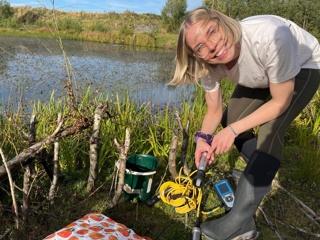
Alice Turner PhD researcher at the University of Stirling, UK.
 Can you tell us a bit about yourself and your research interests?
Prior to commencing a PhD, I completed a BSc (Hons) in Criminal Psychology at Bucks New University and worked in the criminal justice system for a number of years. Not fully satisfied with my day-to-day, I completed an MSc in Human Animal Interactions at the University of Stirling in 2022, generating my dissertation on the moral standing of wildlife and public attitudes towards conservation. This marked a huge shift in my career trajectory and reinforced my desire to pursue a career with wildlife and nature. My current PhD is interdisciplinary and spans ecology and social science – exploring anthropogenic pressures on beavers as well as sociocultural perceptions of beavers. My other research interests include ecosystem restoration, nature connectedness, and nature policy.
What first interested you in this field of research?
I’m a strong advocate for coexistence between people and nature and knew this was something I wanted to pursue in my studies and as a career. When the opportunity to complete a PhD presented itself, I thought long and hard about what I wanted my project to focus on, though I was sure I wanted to encompass both human and wildlife elements. I knew a little about the incredible ecosystem engineering abilities of beavers but quickly fell in love with them after starting my PhD. They’re fascinatingly industrious creatures and their wetlands quite literally sustain life – not to mention they have a wicked sense of humour and are truly hilarious to watch going about their business!
Can you briefly explain the research you presented at SCCS 2025?
At SCCS 2025, I presented a poster of my project on whether beaver foraging behaviour is affected by anthropogenic pressures in the landscape. Spoiler alert – it is! Firstly, I found that beaver foraging trails are shorter in agricultural areas. Not only does this indicate that beavers perceive these landscapes as threatening, it also means that beaver activity, such as burrowing, is concentrated around water banks, which is where a lot of human-beaver conflict is already magnified. On this basis, translocated beavers should not be released into agricultural areas. Secondly, I found that beaver foraging trails are shorter in broadleaved woodland areas. This is consistent with central place forager theories that beavers only travel as far as necessary for food and resources and these findings reinforce the importance of riparian zones in beaver habitats. In other words, with all the resources they need on their doorstep, beavers are less likely travel to adjacent land where they could potentially encounter conflicts with humans. Therefore, beaver release sites should be areas with developed riparian woodland, or those which are planted with native broadleaved trees prior to their release.
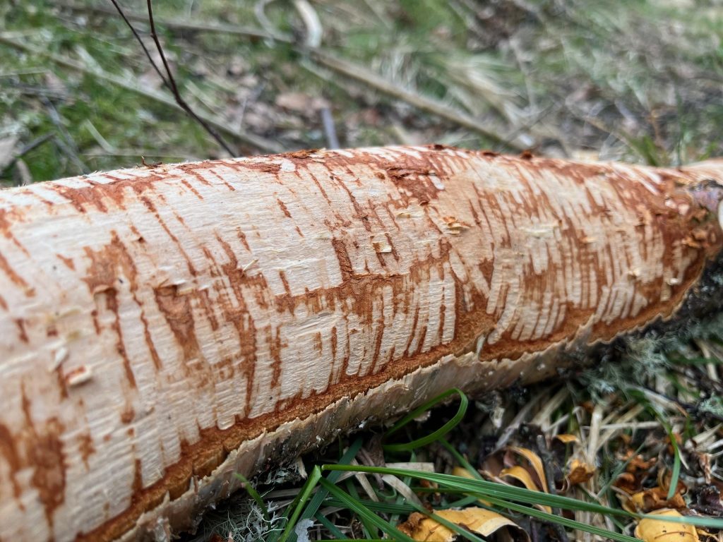
Beaver gnaw
What are your next steps?
This project forms part of a much larger study within my PhD, where I will be exploring the effect of other anthropogenic pressures (noise, light and water pollution) on beaver responses (stress behaviours and body condition). This work will help broaden our understanding of how beaver populations cope within human-dominated landscapes. I’ll also be conducting research into human perceptions of beavers, in an effort to better understand where conflicts arise and what mitigations may be adopted, all with the view to foster greater human-beaver coexistence.
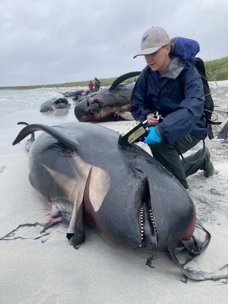
Penny Clarke PhD Researcher at the British Antarctic Survey and the University of Edinburgh, UK.
 Can you tell us a bit about yourself and your research interests?
I am a marine conservationist and remote sensor PhD Researcher interested in advancing technology for cetacean conservation. My PhD is with the SENSE Earth Observation Centre for Doctoral Training, based at the British Antarctic Survey and the University of Edinburgh. This is an internationally collaborative project with University of Massey, CEAZA, Oceanswell, and JNCC, working to develop satellite imagery as a tool for long term stranding monitoring programmes in remote regions.
What first interested you in this field of research?
I’ve wanted to be a marine mammal scientist since I was 12 years old. My lifelong interest was first sparked during a family trip to Tenerife, where I saw dolphins for the first time, and by watching David Attenborough alongside the largest animal ever to roam our planet, the blue whale, in BBC’s Life of Mammals. It wasn’t until 16 years later that I found the courage to truly pursue this dream, thanks to an incredible internship with Dr. Asha de Vos and Oceanswell in Sri Lanka. I left that experience inspired and excited to explore how new technologies could help conserve whales.
In the years that followed, I undertook several internships with the British Antarctic Survey’s Wildlife from Space team studying live (free-swimming) and stranded whales from space. When I joined, the use of satellites to study whales was becoming a reality, due to the launch of satellites that could image Earth with very high detail, allowing whale defining features to be seen from space. I was fortunate to support Chilean researchers applying satellite technology to investigate ongoing sei whale mortality in the Chilean Patagonia, linked to the largest mass mortality of baleen whales ever recorded in 2015. This naturally led to even more questions, like how can we refine this tool to monitor remote regions where no one is watching? That curiosity is what shaped my current research using satellites to study strandings and ocean health from space.
Can you briefly explain the research you presented at SCCS 2025?
Stranding events are important, think canary in the coal mine, strandings can be early warning signs for our oceans. However, in places with no people and limited resources, there’s often no monitoring. So how do we fill the gaps where no one’s watching? I look to space for the answer. Very High-Resolution optical satellites, like the ones behind Google Earth, can capture imagery anywhere on Earth. They’ve already helped detect and count large whale strandings. But here’s the thing: most strandings aren’t giant whales. They’re smaller species of whale and dolphin. So the real question became, just how small a cetacean can we see from space? You’ve heard of Where’s Wally? Well, I played the ultimate game of Where’s Whaley and I found them. I detected and counted the first-ever stranded pilot whales from space. But it wasn’t always easy, there’s the elephant in the room, clouds. Optical satellites can’t see through them and they need daylight too. So I asked, can I see through clouds? Spy on whales in the dark? That’s when I turned to synthetic aperture radar satellites, or SAR. They use microwave radiation to image Earth, in any weather, day or night. And it worked. I detected and counted the first cetacean using SAR. If we can refine this tool and make satellite imagery more accessible, satellites could help stranding networks worldwide work towards achieving their long-term monitoring and conservation goals.
How will you continue to build on this research?
As fun as it is to play Where’s Whaley it takes a huge amount of time to manually review imagery. As a next step I hope to build large high-quality datasets to train machine learning models to automatically detect stranded whales in imagery. This will be important in helping us to scale up monitoring to cover larger areas and more often. Then unlike most wildlife from space, stranded cetaceans are constantly changing shape, size and colour as they decompose, I plan to explore the impact of decomposition on detection. This will be important in regions of recurring strandings, to ensure fresh strandings can be quantified accurately. Finally, one of the greatest challenges to scaling up the use satellite imagery for cetacean conservation, is the cost of access to satellite imagery. The current costs risks facilitating colonial science narratives, which could see researchers in well-resourced countries studying coastlines around the world from the comfort of their home, without making any investment locally. Aside of working to share my knowledge and research open-source, I am co-convening an international community of researchers actively using satellites to study whales through the International Whaling Commission Scientific Committee. As a group we are aiming to tackle accessibility and the future integration of this tool for conserving cetaceans, by working collaboratively and building partnership with satellite image providers.